What does your Project need
Our services apply where planning results are not only drawn, but also structured, reviewed, modeled, and transferred into digital workflows.
A structured entry point into specific project requirements.
The register structure serves as a fast introduction to operational planning, modeling, and data processes.
2D · 3D · CAD
and Layout
Plan versions, technical drawings, and model development.
BIM
Information models, attributes, and coordination.
GIS
Spatial data, location references, and geospatial analysis.
Pre-Design
Early analysis before design and technical definition.
CAD-
Automation
Interfaces, APIs, and recurring processes.
Digitali-
zation
Scans, PDFs, and re-vectorization of legacy plan versions.

2D · 3D CADand Layout
We create and revise CAD data when plans need to be technically reliable, cleanly structured, and directly reusable — from precise 2D foundations to 3D models for design, execution, and documentation.
What is created in concrete terms
- 2D CAD, plan layout, labeling, dimensioning, and plan management with clear layer structure, scale logic, plot styles, and reviewable plan versions
- 3D CAD, parametric models, components, assemblies, and technical systems including clean model hierarchy, references, and reusable component logic
- Formwork, reinforcement, construction, and execution drawings with traceable sections, details, connections, position references, and revision-ready documentation
- Technical illustrations, manuals, and documentary planning graphics for assembly, operation, coordination, tendering, and later technical handovers
- Plan cleanup, data review, and preparation for handovers to specialist planning or execution, including checking XRefs, blocks, linetypes, units, and file standards
When internal capacity becomes tight
Under time pressure, plan versions often emerge that work in the short term but later make coordination, review, and further processing more difficult. We clean up geometries, layers, layouts, references, blocks, dimension chains, and updates so that working versions become reliable project foundations again. We pay attention to clear plan logic, clean file structures, traceable revisions, and preparation that can either be continued internally or safely handed over externally.
CAD between technology and communication
CAD data must do more than represent geometry. It must be clearly readable, reviewable, versionable, and connectable — for specialist planning, engineering, plant construction, manufacturing, documentation, and later handovers. That is why we treat plans not only as drawings, but as a technical information base: with clear layers, consistent references, reliable dimensions, and a structure that remains understandable even after several project phases.
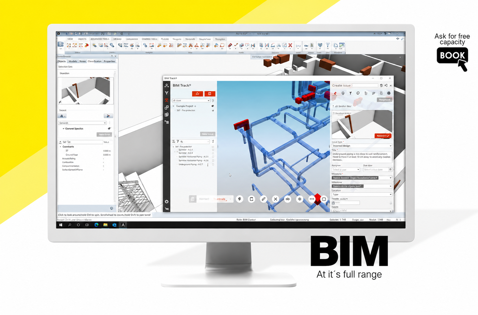
Building InformationModeling
BIM only becomes usable when geometry, component information, and model structure work together. We build, review, and maintain models so that they can be coordinated, evaluated, and handed over to other project participants without data breaks.
What we work on
- Model creation, model maintenance, and model structure with clean story, component, phase, and reference logic for coordinable specialist models
- Attribution, classification, and component logic according to project requirements, information needs, evaluation goals, and later handover formats
- IFC handovers, Open BIM workflows, and data consistency including review of property sets, object assignment, export logic, and model readability
- Coordination between specialist models, plan versions, and information requirements so that architecture, structural engineering, MEP, existing conditions, and evaluation work on the same data logic
- Review of model quality, attributes, IFC exports, and evaluable component data with regard to clash control, quantity takeoff, documentation, and handover readiness
Not every 3D model is BIM
A spatial model is not yet a reliable BIM model. The decisive question is whether components are correctly classified, whether attributes are maintained consistently, and whether the model structure works for coordination, quantities, handovers, and later evaluation. We review not only visible geometry, but also object logic, information content, naming conventions, model setup, and whether the data can actually be used in the next process step.
Handovers without data breaks
We review the typical breaking points in the BIM process: missing attributes, inconsistent classifications, incorrect object logic, unclear IFC exports, or models that look right visually but cannot be evaluated professionally. The goal is a handover in which information does not have to be manually reinterpreted, but continues reliably in coordination, quantity takeoff, quality assurance, and documentation.
GeospatialApplications
GIS makes spatial dependencies visible before they become expensive in the project. We prepare geodata so that location, area, infrastructure, terrain, environmental factors, and usage conflicts can be evaluated professionally.
Typical GIS work
- Geodata preparation, layer logic, and map structures with clear coordinate systems, data sources, attributes, and traceable display logic
- Spatial analyses, overlays, and location references for area potentials, restrictions, access, distances, catchment areas, and variant comparisons
- Infrastructure, environmental, terrain, and planning data from different sources, combined into reliable, reviewable, and project-specific evaluable datasets
- Linking CAD/BIM foundations with geospatial contexts so that object planning, location reference, existing conditions, terrain, and surroundings are professionally brought together
- Preparation of spatial data for coordination, approval, variant comparison, and communication with clear map images, traceable evaluations, and documented assumptions
Many planning questions lie outside the object
Many relevant planning risks lie outside the building or object: terrain, access, climate, neighborhood, protection zones, area references, or usage conflicts. GIS brings these layers into a reviewable context. This makes dependencies visible that are often noticed too late in conventional plans — such as elevation references, clearance areas, overlaps with infrastructure, environmental restrictions, or conflicts between existing conditions and planned use.
Maps are only the surface
A map is only the visible result. What matters is the data logic behind it: relevant layers, reliable overlays, clear spatial references, and evaluations that do not merely illustrate decisions, but justify them. We ensure that datasets are derived transparently, located geometrically correctly, and structured in such a way that they can be reused for variants, approvals, reports, and technical coordination.
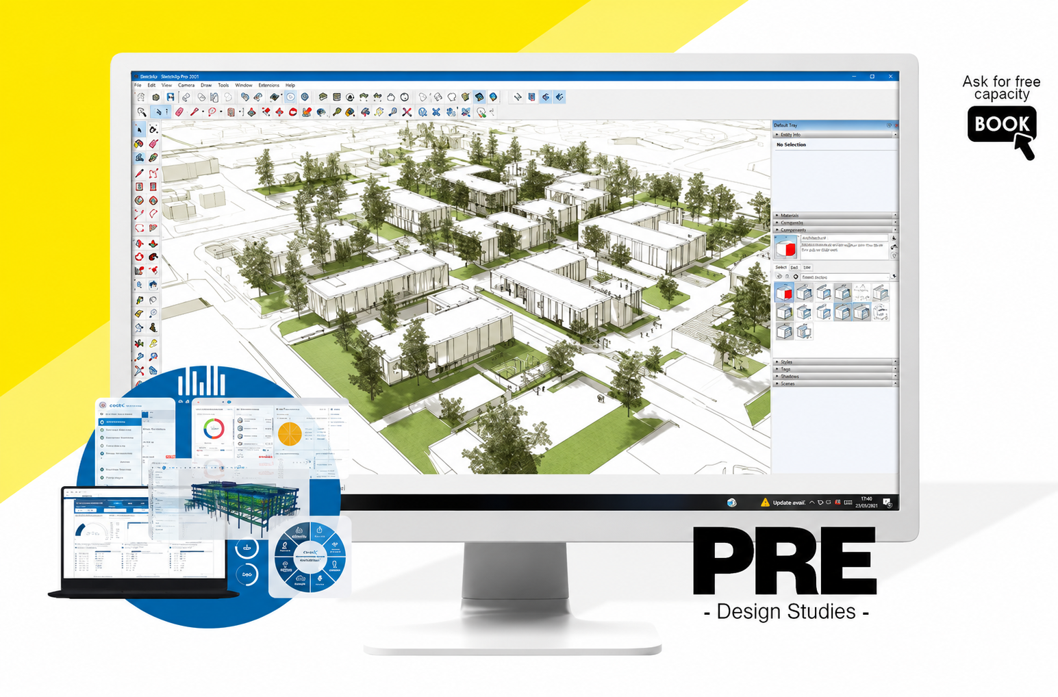
Pre-DesignStudies
Pre-design reviews the foundations before design decisions are fixed. Location, climate, use, life cycle, materiality, and technical requirements are analyzed early so that assumptions do not have to be corrected expensively in later service phases.
What is reviewed
- Location, orientation, shading, and microclimatic influences as concrete decision-making foundations for design, use, comfort, energy demand, and construction strategy
- Use, service life, materiality, and technical requirements including area logic, operational requirements, maintainability, robustness, and later adaptability
- Facade, daylighting, ventilation, and shading strategies with regard to daylight, summer heat protection, user comfort, and technical feasibility
- Preparatory CAD-, BIM-, and GIS-based analysis foundations so that spatial, technical, and location-related information can be evaluated together early on
- Early review of feasibility, risks, dependencies, and technical consequences before design decisions, cost assumptions, or approval strategies are fixed
Preliminary planning begins before the plan
Many projects make design decisions before location data, usage scenarios, technical dependencies, or life-cycle questions have been sufficiently reviewed. Pre-design moves this review to the point where changes are still controllable. This means variants are compared not only aesthetically, but evaluated based on reliable parameters: climate, orientation, access, space program, technical feasibility, material strategy, and long-term use.
Context becomes a planning parameter
Orientation, climate, use, materiality, energy demand, and life cycle are not treated as side issues, but as concrete planning parameters for reliable variants, better decisions, and fewer later corrections. We translate context into reviewable foundations: which assumptions hold, which risks become visible early, and which technical consequences arise from location, program, and use.

CAD AutomationAPIs - Plugins
Wherever CAD, BIM, or project data is repeatedly read, written, checked, or transferred, errors, media breaks, and unnecessary effort arise. We translate such workflows into stable digital processes, scripts, and interfaces.
Where automation helps
- Reading, extracting, and checking CAD/BIM data including attributes, layers, blocks, model information, tables, exports, and project-specific checking rules
- API connections, scripts, plugin logic, and data handovers for recurring workflows between CAD, BIM, databases, project platforms, and specialist software
- Interfaces to AVA, specialist software, CDE, and project platforms so that information does not have to be maintained twice, transferred manually, or corrected afterward
- Automation of repetitive planning and documentation steps such as plan lists, data checks, exports, naming, attribute maintenance, quantity takeoffs, or handover packages
- Rule-based data validation, consistency checks, and process documentation with transparent checking steps, reproducible results, and reduced manual susceptibility to errors
Not coding for its own sake
Automation makes sense when it measurably removes friction from the project: less manual repetition, fewer copy-paste errors, more consistent data versions, and clearer workflows between planning, review, and handover. That is why every automation starts with process logic: Which data is needed, where do errors arise, which rules can be clearly mapped, and at what point does a script actually save time, questions, or corrections?
Interfaces decide everyday usability
Many digital processes do not fail because of the individual software, but because of the transitions: wrong formats, manual exports, unclear responsibilities, or inconsistent data versions. We look at the entire data flow between tools, disciplines, and project environments. This results in practical interfaces, checking mechanisms, and small, robust tools that fit existing workflows instead of creating new isolated solutions.
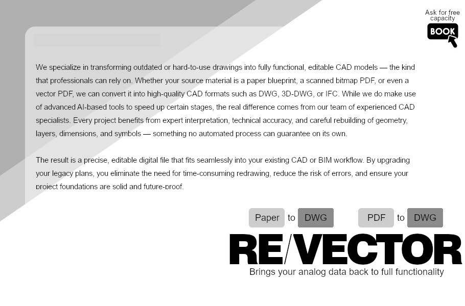
DigitizingExisting Plans
Old paper plans, scans, or PDFs are often the only available foundation — but not yet a reliable working basis. We convert analog or unstructured existing documents into clean digital CAD structures that planning can continue working with precisely.
What it becomes
- Digitization of analog planning foundations with review of scale, readability, plan status, distortions, missing information, and project-related usability
- Re-vectorization from scans, PDFs, and paper plans including tracing relevant geometries, structuring layers, cleaning up lines, and reconstructing technical information
- Reconstruction in clean CAD structures with clear levels, blocks, labels, dimensions, references, and traceable plan organization
- Plan preparation for architecture, engineering, and technical systems so that existing conditions, conversion, renovation, MEP, structural engineering, or documentation can continue working on reliable data
- Cleanup of damaged, non-scale, or inconsistent existing data with comparison of dimension chains, plan logic, references, sections, details, and visible contradictions
A scan is not yet a foundation
A scan shows information, but it is not yet a reliable planning foundation. Only when scale accuracy, geometry, layer logic, labeling, and plan structure have been cleanly reconstructed can existing conditions be used professionally again. We distinguish between visible information, plausible reconstruction, and open ambiguities so that later planners know which data is reliable and where existing conditions need to be checked.
Digitization is project preparation
Re-vectorization is not merely diligent manual work, but project preparation. It creates the foundation on which CAD, BIM, and engineering processes can cleanly build — without constant questions, retracing, and correction loops. The better existing conditions are digitally structured, the more reliably conversion planning, technical review, quantity takeoff, model creation, and later documentation function.